
The Land
Bois d’Arc Creek arises in Grayson county just to the west of the Fannin County line. The creek crosses into Fannin County at roughly the midpoint of the county’s western boundary, travels a bit south and east to wrap around the town of Randolph, then marches northeast through the heart of the county to empty into the Red River near the Lamar county line, more than 60 miles from its source. Larger than many rivers, powerful, destructive, and life bringing, it is the dominant geographic feature of Fannin, County, Texas, the backbone of the landscape. Once the dam, now under construction, is completed, more than 16,000 acres of Bois d’Arc Creek, its bottomlands, and its tributaries will form a lake impounding more than 360,000 acre-feet of water (Statistics from the North Texas Municipal Water District). The lake will replace the creek as the dominate feature of the landscape, and the $1.6 billion project and its aftermath will transform the economic base of the area from agriculture to recreation.
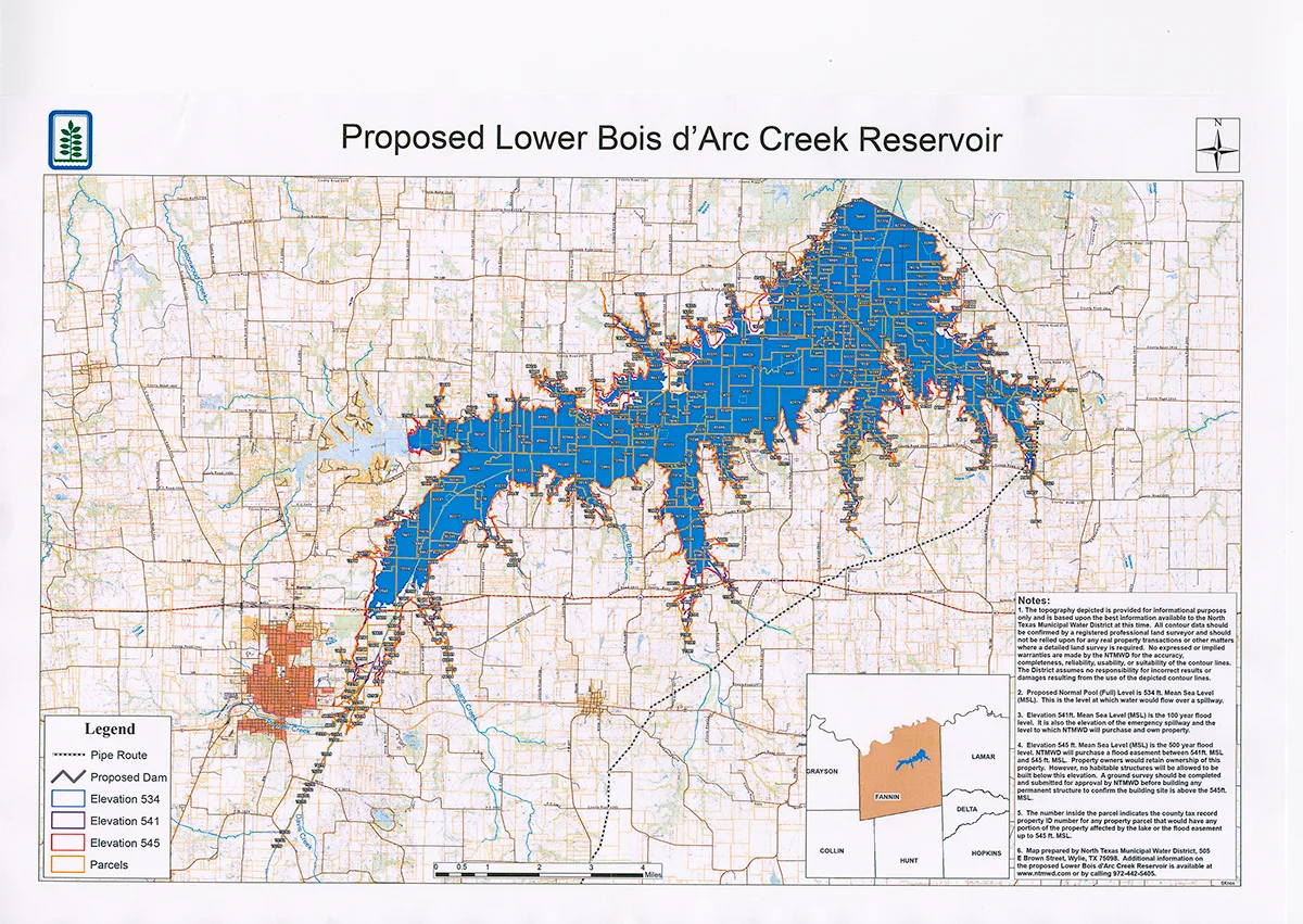
Map used with permission by courtesy of the North Texas Municipal Water District.
Not since cotton was king has this area seen such significant investment or anticipated such significant growth. In fact, the Handbook of Texas tells us that the “population of Fannin County peaked in 1900 at 51,793 and [has] slowly decreased afterward.” The Handbook also says that corn production, the number of farms (7,202), and the number of businesses reached their historical highs in the same year. Cotton continued to drive the economy until production peaked in 1920. The US Census Bureau pegs the population in July, 2017, at just over 34,400, and environmental studies leading up to the permitting of the lake point out that the land use patterns within the county have changed very little over the last 100+ years.
Living descendants of the Wilks family have described the road to the cemetery, today a rough trail on private property as seen in the image below, as a major road serving a significant number of farming families living in the bottom in the early part of the 20th century. Consolidation has occurred over the years, as the county population declined, with fewer owners now controlling larger tracts; and perhaps some areas are less intensely farmed now than they might have been at the dawn of the 20th century. Some owners are relatively new to the area, having sought a rural haven from the stresses of urban life. Some owners have long connections to the land and continue the agricultural practices of generations of their family.

The Road In, photo by Wanda Holmes Oliver.
The Google Earth image below captures the area near the location of the new dam, and visually reinforces these described land uses, while providing a bird’s eye view of the condition of the land prior to the beginning of construction. Undeveloped tracts alternate with fields and pastures.
In addition to the evident agriculture and ranching, the undeveloped bottomlands of Bois d’Arc Creek and its tributaries have long provided rich hunting and fishing. For many of us who’ve grown up in Fannin County, tromping around in the bottoms has been a rite of passage, and stories of deer camps, duck hunts, fishing trips, hog traps, dove, and quail bubble up readily today in any discussion of the upcoming construction of the lake. The bottom lands have always been our play ground.
This aerial image also locates the two affected cemeteries within the overall picture. The southern extension of Coffee Mill Lake will help to situate future views as construction progresses.

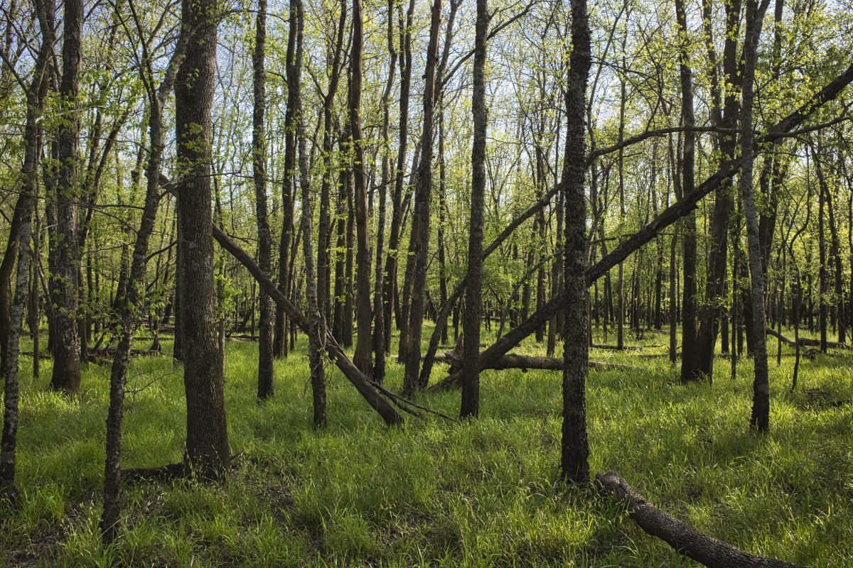
The following images are of actual locations near the dam that will be lost to construction, and include typical examples of undeveloped bottoms, open meadows, wetlands, and family farms, They are a homage to what is being lost - a bittersweet reality for even the most ardent proponents of progress.
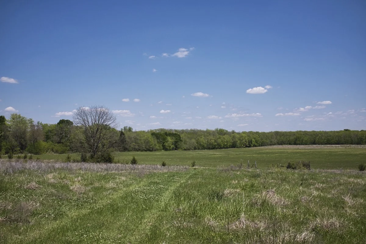
Cordell’s Ridge, photo by Wanda Holmes Oliver.
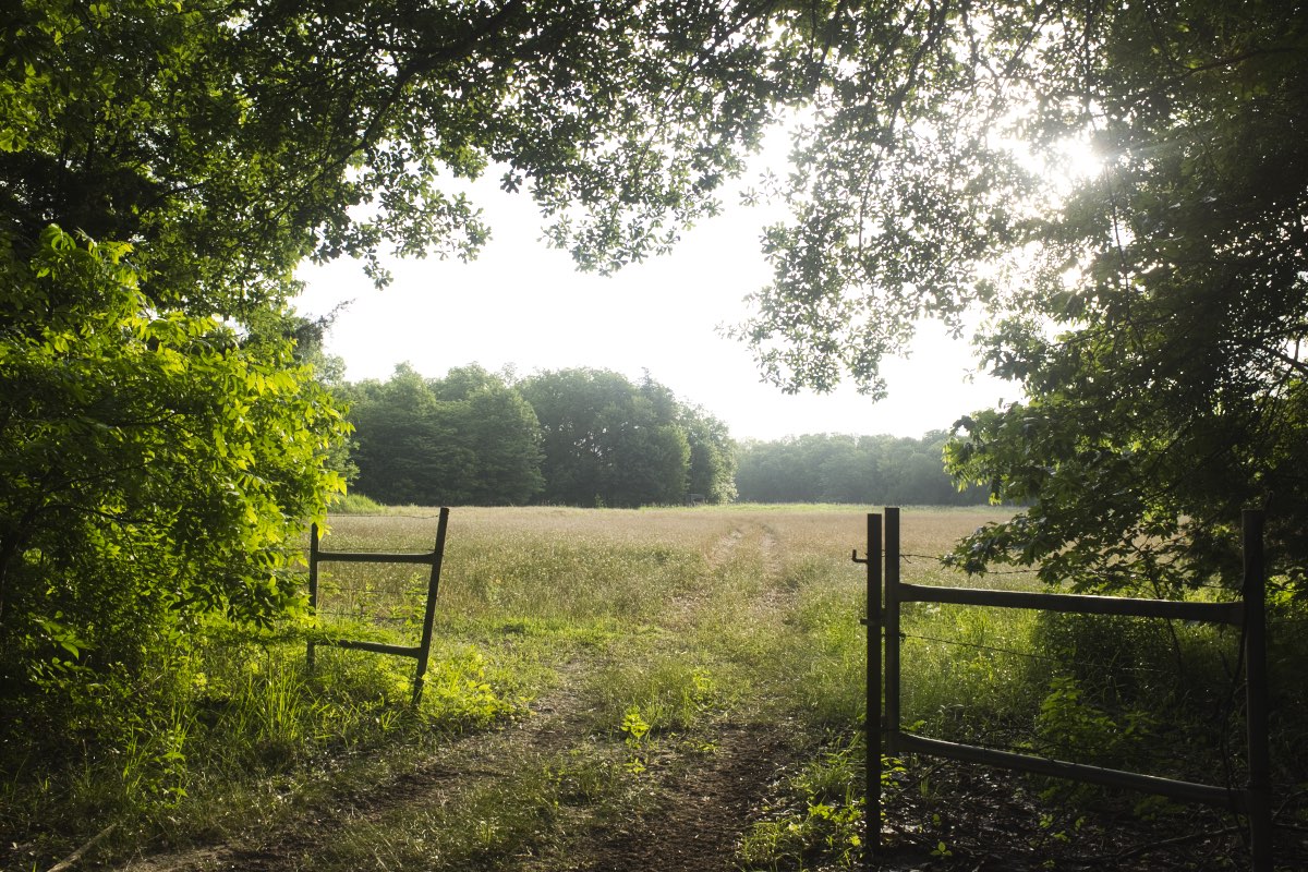
Gateway to Paradise, photo by Wanda Holmes Oliver.
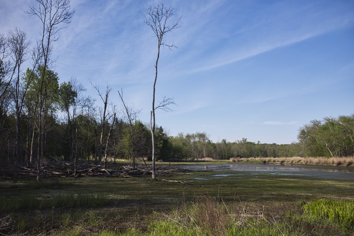
Bottom Wetlands, photo by Wanda Holmes Oliver.
The Bottom, photo by Wanda Holmes Oliver.